
1972 Map of Tejana Mesa
USGS Topo · Published 1976About this map
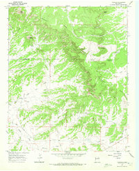
Tejana Mesa dominates this corner of Catron County, its high plateau flanked by deep erosional cuts and winding watercourses in the early 1970s. The landscape is defined by the high-desert cattle industry, centered on small outposts like the Chavez Ranch, Mesa Ranch, and El Porticito. Water management in this arid environment is evident through named infrastructure such as the Old Tejana Well and New Well, which served as vital lifeblood for remote ranching operations. Drainage patterns follow the natural contours of Tejana Draw and Lopez Draw, while Largo Creek winds through the southern reaches of the quadrangle. This survey captures a moment when the rugged interior of New Mexico was primarily the domain of family-run ranching estates and scattered watering holes before modern consolidation and development altered the rural footprint.
Find a feature on this map
13 named features on this map. Tap any name to fly to it.
Don’t see what you’re looking for? This feature index may not catch every label — zoom into the map to look around manually.
Map Details
Editions of this 1972 Tejana Mesa Map
This is the sole edition of this map. No revisions or reprints were ever made.
Other maps of this area

1954 · Saint Johns
USGS Topo · 1:250,000

1957 · Saint Johns
USGS Topo · 1:250,000

1958 · Saint Johns
USGS Topo · 1:250,000

1962 · Saint Johns
USGS Topo · 1:250,000

1967 · Mariano Springs
USGS Topo · 1:24,000

1967 · Quemado
USGS Topo · 1:24,000
1967 · Techado
USGS Topo · 1:24,000

1972 · Lake Armijo
USGS Topo · 1:24,000
1972 · Cerro Prieto
USGS Topo · 1:24,000

1972 · Fence Lake SW
USGS Topo · 1:24,000