
1972 Map of Fence Lake SW
USGS Topo · Published 1976About this map
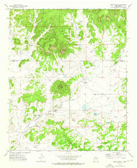
Santa Rita Mesa dominates the high ground of this western New Mexico landscape, a region defined by its critical water sources and ranching history in the early 1970s. The map illustrates a reliance on scattered water points, ranging from the historic Old Santa Rita Springs and New Santa Rita Springs to mechanical improvements like the Medanoso Windmill and Espejeda Windmill. These features indicate the persistent effort to sustain livestock in an arid environment where drainage patterns like Largo Draw and Tejana Draw provide only seasonal relief.
Find a feature on this map
21 named features on this map. Tap any name to fly to it.
Don’t see what you’re looking for? This feature index may not catch every label — zoom into the map to look around manually.
Map Details
Editions of this 1972 Fence Lake SW Map
This is the sole edition of this map. No revisions or reprints were ever made.
Other maps of this area

1954 · Saint Johns
USGS Topo · 1:250,000

1957 · Saint Johns
USGS Topo · 1:250,000

1958 · Saint Johns
USGS Topo · 1:250,000

1962 · Saint Johns
USGS Topo · 1:250,000

1972 · Zuni Salt Lake
USGS Topo · 1:24,000

1972 · Lake Armijo
USGS Topo · 1:24,000

1972 · Fence Lake
USGS Topo · 1:24,000

1972 · Tejana Mesa
USGS Topo · 1:24,000
1972 · Cerro Prieto
USGS Topo · 1:24,000
1972 · The Dyke
USGS Topo · 1:24,000