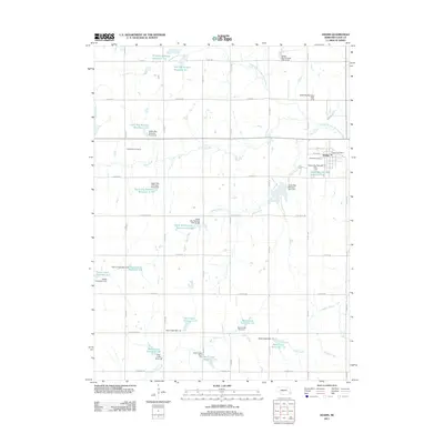
2011 Map of Adams
USGS Topo · Published 2011About this map
Adams serves as the primary hub in this corner of Gage County, where a grid of section-line roads like E Ash Rd and E Pickrell Rd organizes the agricultural landscape. The town is marked by local landmarks including the Adams Post Office and Highland Cemetery, while Grandview Cemetery sits further west among the fields. This terrain is defined by a dense network of water management features, illustrating a highly engineered approach to the prairie's drainage. Numerous reservoirs and dams, such as Bear Creek Reservoir 7-F and M B Big Nemaha Reservoir 9-C, dot the landscape along the tributaries of the Middle Branch Big Nemaha River. These man-made structures regulate the flow of natural waterways like Shaw Creek, Jakes Creek, and Hooker Creek, which meander through the farmland towards the larger river system.
Find a feature on this map
46 named features on this map. Tap any name to fly to it.
Don’t see what you’re looking for? This feature index may not catch every label — zoom into the map to look around manually.
Map Details
Editions of this 2011 Adams Map
This is the sole edition of this map. No revisions or reprints were ever made.
Other maps of this area

1897 · Lincoln
USGS Topo · 1:125,000

1903 · Weeping Water
USGS Topo · 1:125,000

1929 · Weeping Water
USGS Topo · 1:125,000

1955 · Lincoln
USGS Topo · 1:250,000

1957 · Lincoln
USGS Topo · 1:250,000

1957 · Beatrice East
USGS Topo · 1:24,000

1958 · Lincoln
USGS Topo · 1:250,000

1964 · Cortland
USGS Topo · 1:24,000

1964 · Pickrell
USGS Topo · 1:24,000

1965 · Adams
USGS Topo · 1:24,000