
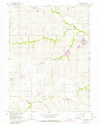
1965 Map of Adams
USGS Topo · Published 1966About this map
The Adams townsite serves as the primary hub of this mid-1960s agricultural landscape, situated at the junction of the Chicago and North Western and Burlington Quincy railroads. The town features a central Park and its own Sewage Disposal facility, reflecting a self-contained community during a period of steady growth. The surrounding townships of Nemaha, Hanover, and Hooker are defined by a network of rural schoolhouses and family-named landmarks, including Grandview School, Little John School, and Remmers School.
Find a feature on this map
17 named features on this map. Tap any name to fly to it.
Don’t see what you’re looking for? This feature index may not catch every label — zoom into the map to look around manually.
Map Details
Editions of this 1965 Adams Map
2 editions found
Other maps of this area

1897 · Lincoln
USGS Topo · 1:125,000

1903 · Weeping Water
USGS Topo · 1:125,000

1929 · Weeping Water
USGS Topo · 1:125,000

1955 · Lincoln
USGS Topo · 1:250,000

1957 · Lincoln
USGS Topo · 1:250,000

1957 · Beatrice East
USGS Topo · 1:24,000

1958 · Lincoln
USGS Topo · 1:250,000

1964 · Cortland
USGS Topo · 1:24,000

1964 · Pickrell
USGS Topo · 1:24,000

1965 · Crab Orchard
USGS Topo · 1:24,000