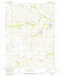
1965 Map of Adams
USGS Topo · Published 1980About this map
Adams stands as the primary hub of this eastern Nebraska landscape, situated at the junction of the Chicago Burlington and Quincy railroad and the Middle Branch Big Nemaha River. The surrounding townships of Nem Aha, Hanover, and Hooker reveal a rural infrastructure defined by section-line roads and family-named watercourses like Shaw Creek and Bear Creek.
Find a feature on this map
17 named features on this map. Tap any name to fly to it.
Don’t see what you’re looking for? This feature index may not catch every label — zoom into the map to look around manually.
Map Details
Editions of this 1965 Adams Map
2 editions found
Other maps of this area

1897 · Lincoln
USGS Topo · 1:125,000

1903 · Weeping Water
USGS Topo · 1:125,000

1929 · Weeping Water
USGS Topo · 1:125,000

1955 · Lincoln
USGS Topo · 1:250,000

1957 · Lincoln
USGS Topo · 1:250,000

1957 · Beatrice East
USGS Topo · 1:24,000

1958 · Lincoln
USGS Topo · 1:250,000

1964 · Cortland
USGS Topo · 1:24,000

1964 · Pickrell
USGS Topo · 1:24,000

1965 · Adams
USGS Topo · 1:24,000