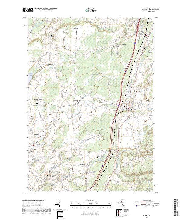
2023 Map of Adams
USGS Topo · Published 2023About this map
Adams and its surrounding hamlets occupy a landscape defined by the drainage of Sandy Creek and the expansive wetlands of Adams Swamp. This recent survey details the enduring agricultural and residential character of southern Jefferson County, where small clusters like Thomas Settlement, Green Settlement, and Taylor Settlement remain distinct points on the local road network. The region is marked by numerous family and community burial grounds, including Saint Johns Cem and Evergreen Cem near Roberts Corner, as well as Union Cem in Adams Center. Topographical features such as Pine Hill and Prospect Hill rise above the stream valleys of Stony Creek and Taylor Brook, while the southeastern corner is carved by the deep ravines of Towle Gulf and Mooney Gulf. The map traces the modern transit corridor that connects these established settlements, showing how contemporary infrastructure overlays a historic pattern of crossroads and rural neighborhoods.
Find a feature on this map
94 named features on this map. Tap any name to fly to it.
Don’t see what you’re looking for? This feature index may not catch every label — zoom into the map to look around manually.
Map Details
Editions of this 2023 Adams Map
This is the sole edition of this map. No revisions or reprints were ever made.
Other maps of this area

1893 · Sackets Harbor
USGS Topo · 1:62,500

1895 · Sacketts Harbor
USGS Topo · 1:62,500

1895 · Pulaski
USGS Topo · 1:62,500

1895 · Watertown
USGS Topo · 1:62,500

1898 · Watertown
USGS Topo · 1:62,500

1903 · Orwell
USGS Topo · 1:62,500

1905 · Orwell
USGS Topo · 1:62,500

1908 · Watertown
USGS Topo · 1:62,500

1909 · Watertown
USGS Topo · 1:62,500

1942 · Henderson Bay
USGS Topo · 1:31,680