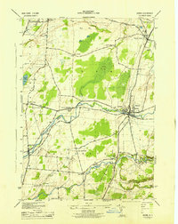
1943 Map of Adams
USGS Topo · Published 1943About this map
The village of Adams and the agricultural lands of southern Jefferson County are captured here during the early 1940s, a period when the Central New York RR served as a vital transit corridor through Adams Center. The landscape is defined by the winding paths of the North Branch Sandy Creek and South Branch Sandy Creek, which navigate a terrain of drumlins and lowland features like the expansive Adams Swamp.
Find a feature on this map
43 named features on this map. Tap any name to fly to it.
Don’t see what you’re looking for? This feature index may not catch every label — zoom into the map to look around manually.
Map Details
Editions of this 1943 Adams Map
This is the sole edition of this map. No revisions or reprints were ever made.
Other maps of this area

1893 · Sackets Harbor
USGS Topo · 1:62,500

1895 · Sacketts Harbor
USGS Topo · 1:62,500

1895 · Pulaski
USGS Topo · 1:62,500

1895 · Watertown
USGS Topo · 1:62,500

1898 · Watertown
USGS Topo · 1:62,500

1903 · Orwell
USGS Topo · 1:62,500

1905 · Orwell
USGS Topo · 1:62,500

1908 · Watertown
USGS Topo · 1:62,500

1909 · Watertown
USGS Topo · 1:62,500

1942 · Henderson Bay
USGS Topo · 1:31,680