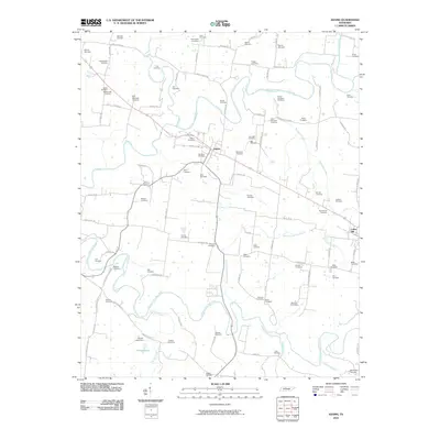
2010 Map of Adams
USGS Topo · Published 2010About this map
Adams and Cedar Hill anchor this rural Robertson County landscape, where the Red River and its major tributaries, the Sulphur Fork Red River and Elk Fork, carve through the terrain. The area is exceptionally dense with family cemeteries, reflecting generations of agricultural settlement and local lineage. Notable sites like the John Bell Cemetery and Bellwood Cemetery sit near the town center, while others like Fort-Wimberly Cemetery and James Johnston Cemetery are located along the winding river bends and secondary roads. The map captures the modern road network, including Port Royal Rd and Keysburg Rd, which follow historical corridors between farmsteads. To the south, Harper Lake and various spring branches like Chambers Spring Branch drain into the primary river systems, defining the drainage patterns of this productive Middle Tennessee farmland.
Find a feature on this map
83 named features on this map. Tap any name to fly to it.
Don’t see what you’re looking for? This feature index may not catch every label — zoom into the map to look around manually.
Map Details
Editions of this 2010 Adams Map
This is the sole edition of this map. No revisions or reprints were ever made.
Other maps of this area

1903 · Nashville
USGS Topo · 1:125,000

1931 · Ridgetop
USGS Topo · 1:62,500

1935 · Ridgetop
USGS Topo · 1:62,500

1950 · Allensville
USGS Topo · 1:24,000

1950 · Guthrie
USGS Topo · 1:24,000

1951 · Dot
USGS Topo · 1:24,000

1952 · Springfield North
USGS Topo · 1:24,000

1956 · Nashville
USGS Topo · 1:250,000

1957 · Adams
USGS Topo · 1:24,000

1957 · Pleasant View
USGS Topo · 1:24,000