
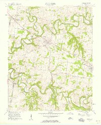
1957 Map of Adams
USGS Topo · Published 1958About this map
The winding Red River and its major tributaries, including Elk Fork and Sulphur Fork, define the landscape of Robertson and Montgomery Counties in the late 1950s. The Louisville and Nashville railroad cuts a straight line through the undulating terrain, serving as the backbone for rural communities like Adams and Sadlersville. This era shows a well-established network of country roads, such as Barnes Rd and Mint Spring Road, connecting small clusters of homes and family farms.
Find a feature on this map
32 named features on this map. Tap any name to fly to it.
Don’t see what you’re looking for? This feature index may not catch every label — zoom into the map to look around manually.
Map Details
Editions of this 1957 Adams Map
4 editions found
Other maps of this area

1903 · Nashville
USGS Topo · 1:125,000

1931 · Ridgetop
USGS Topo · 1:62,500

1935 · Ridgetop
USGS Topo · 1:62,500

1950 · Allensville
USGS Topo · 1:24,000

1950 · Guthrie
USGS Topo · 1:24,000

1951 · Dot
USGS Topo · 1:24,000

1952 · Springfield North
USGS Topo · 1:24,000

1956 · Nashville
USGS Topo · 1:250,000

1957 · Pleasant View
USGS Topo · 1:24,000

1957 · Henrietta
USGS Topo · 1:24,000