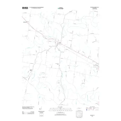
2013 Map of Adams
USGS Topo · Published 2013About this map
The Red River and Sulphur Fork Red River define the winding agricultural landscape of northern Tennessee in this early twenty-first-century survey. The settlement of Adams serves as a central hub, where the local road network converges near the riverbanks. To the northwest, the small community of Sadlersville sits along the rail corridor, while Walnut Grove occupies the western reaches of the quadrangle. The land is characterized by numerous small watercourses, including Sturgeon Cr and Brush Cr, which feed into the larger river systems. This era reflects a deep-rooted agricultural tradition, exemplified by the Shade Tree Farm and Orchard. Genealogists and local historians can trace family landholdings through namesake routes like John Farmer Rd, Ralph Head Rd, and Toby Darden Rd, which weave together the rural farmsteads and creek bottoms of Robertson County.
Find a feature on this map
92 named features on this map. Tap any name to fly to it.
Don’t see what you’re looking for? This feature index may not catch every label — zoom into the map to look around manually.
Map Details
Editions of this 2013 Adams Map
This is the sole edition of this map. No revisions or reprints were ever made.
Other maps of this area

1903 · Nashville
USGS Topo · 1:125,000

1931 · Ridgetop
USGS Topo · 1:62,500

1935 · Ridgetop
USGS Topo · 1:62,500

1950 · Allensville
USGS Topo · 1:24,000

1950 · Guthrie
USGS Topo · 1:24,000

1951 · Dot
USGS Topo · 1:24,000

1952 · Springfield North
USGS Topo · 1:24,000

1956 · Nashville
USGS Topo · 1:250,000

1957 · Adams
USGS Topo · 1:24,000

1957 · Pleasant View
USGS Topo · 1:24,000