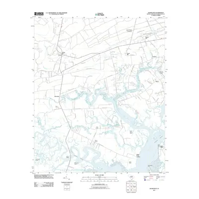
2011 Map of Adams Run
USGS Topo · Published 2011About this map
Adams Run serves as the inland anchor for this coastal South Carolina landscape, where the Adams Run Post Office marks the intersection of historic transit routes. The geography is defined by a labyrinth of tidal passages and marshy islands, including Jehossee Island, Park Island, and Little Britton Island, which separate the mainland from the North Edisto River. The water-dependent nature of the region is evident in the orientation of settlements like White Point Landing and Bears Bluff along the Wadmalaw River and Intracoastal Waterway. This area preserves a legacy of family-named roads and plantation-era boundaries, such as those near Lems Bluff Plantation Rd and Prices Cemetery. The proximity of the Too Goo Doo Farms Airport to established communities like Laroche and Baptist Hill highlights the modern rural-agricultural character that persists alongside these ancient Lowcountry waterways.
Find a feature on this map
96 named features on this map. Tap any name to fly to it.
Don’t see what you’re looking for? This feature index may not catch every label — zoom into the map to look around manually.
Map Details
Editions of this 2011 Adams Run Map
This is the sole edition of this map. No revisions or reprints were ever made.
Other maps of this area

1918 · Cottageville
USGS Topo · 1:62,500

1919 · Edisto Island
USGS Topo · 1:62,500

1919 · Wadmelaw Island
USGS Topo · 1:62,500

1920 · Ravenels
USGS Topo · 1:62,500

1943 · Cottageville
USGS Topo · 1:62,500

1943 · Edisto Island
USGS Topo · 1:62,500

1944 · Ravenels
USGS Topo · 1:62,500

1944 · Wadmelaw Island
USGS Topo · 1:62,500

1947 · Savannah
USGS Topo · 1:250,000

1948 · Savannah
USGS Topo · 1:250,000