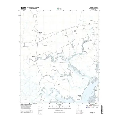
2014 Map of Adams Run
USGS Topo · Published 2014About this map
Adams Run serves as a central hub in this coastal Lowcountry landscape, where the tidal fingers of the Toogoodoo Creek and the Dawho River define the local geography. The map documents a network of rural settlements like Barrelville, Laurel Hill, and Baptist Hill, many of which are connected by historic routes such as Old Military Rd and SC-174. The intricate waterways are essential to the character of the region, featuring prominent landings and islands including White Point Landing and Jehossee Island.
Find a feature on this map
97 named features on this map. Tap any name to fly to it.
Don’t see what you’re looking for? This feature index may not catch every label — zoom into the map to look around manually.
Map Details
Editions of this 2014 Adams Run Map
This is the sole edition of this map. No revisions or reprints were ever made.
Other maps of this area

1918 · Cottageville
USGS Topo · 1:62,500

1919 · Edisto Island
USGS Topo · 1:62,500

1919 · Wadmelaw Island
USGS Topo · 1:62,500

1920 · Ravenels
USGS Topo · 1:62,500

1943 · Cottageville
USGS Topo · 1:62,500

1943 · Edisto Island
USGS Topo · 1:62,500

1944 · Ravenels
USGS Topo · 1:62,500

1944 · Wadmelaw Island
USGS Topo · 1:62,500

1947 · Savannah
USGS Topo · 1:250,000

1948 · Savannah
USGS Topo · 1:250,000