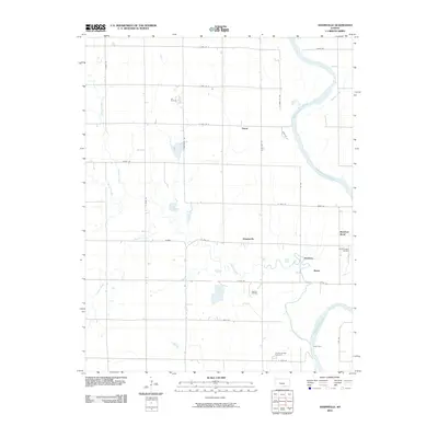
2010 Map of Adamsville
USGS Topo · Published 2010About this map
The Arkansas River meanders through the eastern edge of this landscape, defining the local geography alongside several significant tributaries. Small agricultural and industrial clusters such as Adamsville, Paton, and Hackney are scattered across the section lines, connected by a rigid grid of rural roads like S Greenwich Rd and E 80th St S. This area in Sumner County reflects a long-standing intersection of prairie farming and petroleum extraction, evidenced by the presence of the Lee Oil Field, Holman Oil Field, and Rainbow Bend Oil Field. Near the southern boundary, the Geuda Springs Cemetery serves as a quiet landmark for local genealogists. The meandering course of Slate Creek and Beaver Creek provides a natural contrast to the surveyed road network, while the location of Axley Ford on the river suggests historical crossing points used long before modern bridges dominated the corridor.
Find a feature on this map
36 named features on this map. Tap any name to fly to it.
Don’t see what you’re looking for? This feature index may not catch every label — zoom into the map to look around manually.
Map Details
Editions of this 2010 Adamsville Map
This is the sole edition of this map. No revisions or reprints were ever made.
Other maps of this area

1890 · Wellington
USGS Topo · 1:125,000

1955 · Wichita
USGS Topo · 1:250,000

1958 · Wichita
USGS Topo · 1:250,000

1964 · South Haven NE
USGS Topo · 1:24,000

1964 · Dalton
USGS Topo · 1:24,000

1965 · Portland
USGS Topo · 1:24,000

1965 · Arkansas City
USGS Topo · 1:24,000

1965 · Adamsville
USGS Topo · 1:24,000

1965 · Geuda Springs
USGS Topo · 1:24,000
1965 · Hackney
USGS Topo · 1:24,000