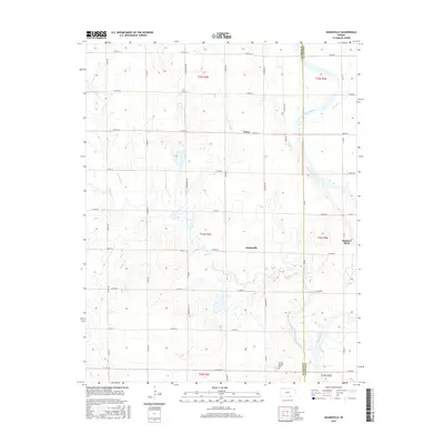
2015 Map of Adamsville
USGS Topo · Published 2015About this map
Adamsville serves as the central focal point of this Kansas landscape, where the agricultural grid meets the winding course of the Arkansas River. The map documents the boundary between Sumner Co and Cowley Co, a transition defined by the river’s path as it flows past the small settlement of Rainbow Bend in the east. North of Adamsville, the tiny community of Paton sits along the E 50th St S corridor, surrounded by a complex network of prairie tributaries including Winser Cr, Badger Cr, and Slate Creek. The inclusion of the Gouda Springs Cem in the south provides a specific point of interest for genealogists tracing family roots in this rural township. The terrain is characterized by these subtle drainage patterns and the established section-line road system that has organized the region's farming for generations.
Find a feature on this map
37 named features on this map. Tap any name to fly to it.
Don’t see what you’re looking for? This feature index may not catch every label — zoom into the map to look around manually.
Map Details
Editions of this 2015 Adamsville Map
This is the sole edition of this map. No revisions or reprints were ever made.
Other maps of this area

1890 · Wellington
USGS Topo · 1:125,000

1955 · Wichita
USGS Topo · 1:250,000

1958 · Wichita
USGS Topo · 1:250,000

1964 · South Haven NE
USGS Topo · 1:24,000

1964 · Dalton
USGS Topo · 1:24,000

1965 · Portland
USGS Topo · 1:24,000

1965 · Arkansas City
USGS Topo · 1:24,000

1965 · Adamsville
USGS Topo · 1:24,000

1965 · Geuda Springs
USGS Topo · 1:24,000
1965 · Hackney
USGS Topo · 1:24,000