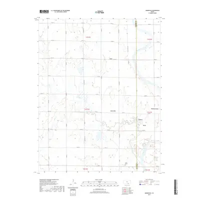
2018 Map of Adamsville
USGS Topo · Published 2018About this map
Adamsville and its surrounding agricultural landscape define the border between Sumner and Cowley counties in southern Kansas. The area is marked by a network of rural settlements, including Paton, Hackney, and Rome, all tied together by a strict section-line road grid that gives way only to the natural curves of the Arkansas River. This river meanders through the eastern portion of the map, joined by several tributaries such as Slate Cr and Winser Cr. This modern survey reveals a landscape largely dedicated to farming, yet it preserves the locations of established community hubs like Rainbow Bend and the Geuda Springs Cem at the southern edge. The contrast between the rigid road system and the fluid, oxbow-laden path of the river highlights the ongoing negotiation between land management and the prairie's natural drainage patterns.
Find a feature on this map
48 named features on this map. Tap any name to fly to it.
Don’t see what you’re looking for? This feature index may not catch every label — zoom into the map to look around manually.
Map Details
Editions of this 2018 Adamsville Map
This is the sole edition of this map. No revisions or reprints were ever made.
Other maps of this area

1890 · Wellington
USGS Topo · 1:125,000

1955 · Wichita
USGS Topo · 1:250,000

1958 · Wichita
USGS Topo · 1:250,000

1964 · South Haven NE
USGS Topo · 1:24,000

1964 · Dalton
USGS Topo · 1:24,000

1965 · Portland
USGS Topo · 1:24,000

1965 · Arkansas City
USGS Topo · 1:24,000

1965 · Adamsville
USGS Topo · 1:24,000

1965 · Geuda Springs
USGS Topo · 1:24,000
1965 · Hackney
USGS Topo · 1:24,000