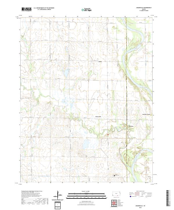
2022 Map of Adamsville
USGS Topo · Published 2022About this map
The Arkansas River carves a wide path through the eastern half of this region, defining the border between Sumner and Cowley counties. This agricultural landscape is centered on the small communities of Adamsville and Paton, where a precise grid of rural roads like S River Rd and E 80th St connects isolated homesteads and farms. The meandering course of Slate Creek and its many oxbows dominate the southeastern quadrant, creating a complex wetland environment near the settlement of Hackney.
Find a feature on this map
47 named features on this map. Tap any name to fly to it.
Don’t see what you’re looking for? This feature index may not catch every label — zoom into the map to look around manually.
Map Details
Editions of this 2022 Adamsville Map
This is the sole edition of this map. No revisions or reprints were ever made.
Other maps of this area

1890 · Wellington
USGS Topo · 1:125,000

1955 · Wichita
USGS Topo · 1:250,000

1958 · Wichita
USGS Topo · 1:250,000

1964 · South Haven NE
USGS Topo · 1:24,000

1964 · Dalton
USGS Topo · 1:24,000

1965 · Portland
USGS Topo · 1:24,000

1965 · Arkansas City
USGS Topo · 1:24,000

1965 · Adamsville
USGS Topo · 1:24,000

1965 · Geuda Springs
USGS Topo · 1:24,000
1965 · Hackney
USGS Topo · 1:24,000