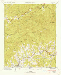
1941 Map of Addie
USGS Topo · Published 1957About this map
Scott Creek serves as the primary corridor through these mountains, carrying the Southern railroad and connecting the riverside settlements of Addie, Beta, and Willets. The landscape is defined by the high ridges of the Plott Balsams and the Divide Ridge, where many small family and community landmarks are recorded. Notable sites include the Norman Cem near Ochre Hill Ch, and the Liberty Sch situated south of the rail line.
Find a feature on this map
101 named features on this map. Tap any name to fly to it.
Don’t see what you’re looking for? This feature index may not catch every label — zoom into the map to look around manually.
Map Details
Editions of this 1941 Addie Map
2 editions found
Other maps of this area

1891 · Cowee
USGS Topo · 1:125,000

1893 · Mt Guyot
USGS Topo · 1:125,000

1897 · Cowee
USGS Topo · 1:125,000

1907 · Cowee
USGS Topo · 1:125,000

1912 · Mt Guyot
USGS Topo · 1:125,000

1933 · Bryson
USGS Topo · 1:62,500

1935 · Dellwood
USGS Topo · 1:24,000

1935 · Tuckaseigee
USGS Topo · 1:24,000

1935 · Hazelwood
USGS Topo · 1:24,000

1935 · Cullowhee
USGS Topo · 1:24,000