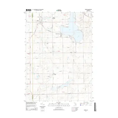
2014 Map of Addison
USGS Topo · Published 2014About this map
Addison and Rollin anchor this portrait of Lenawee County, where the transition between agricultural township lands and the lake district of southern Michigan is clearly defined. The hydrology of the region is dominated by Devils Lake and Round Lake, while the upper reaches of Bean Cr and the S Br River Raisin carve through the surrounding glacial terrain. For the local historian or genealogist, the landscape is punctuated by numerous burial sites, including the Rollin Village Cem, Quaker Cem, and the uniquely noted Morehouse Grave. Former transport corridors are marked by Addison Junction and the Addison Millpond, reflecting the earlier industry of these rural villages. The map also delineates the western boundary with Hillsdale County, capturing the network of section-line roads and family-named homestead sites that have organized this part of the state for generations.
Find a feature on this map
115 named features on this map. Tap any name to fly to it.
Don’t see what you’re looking for? This feature index may not catch every label — zoom into the map to look around manually.
Map Details
Editions of this 2014 Addison Map
This is the sole edition of this map. No revisions or reprints were ever made.
Other maps of this area

1935 · Jackson
USGS Topo · 1:48,000

1939 · Jackson
USGS Topo · 1:62,500

1948 · Manchester
USGS Topo · 1:62,500

1949 · Manchester
USGS Topo · 1:62,500

1953 · Fort Wayne
USGS Topo · 1:250,000

1956 · Fort Wayne
USGS Topo · 1:250,000

1958 · Grand Rapids
USGS Topo · 1:250,000

1961 · Grand Rapids
USGS Topo · 1:250,000

1962 · Grand Rapids
USGS Topo · 1:250,000
1962 · Clayton
USGS Topo · 1:24,000