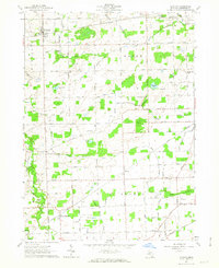
1962 Map of Clayton
USGS Topo · Published 1963About this map
Clayton and the surrounding townships of Hudson and Dover define this mid-century agricultural landscape in Lenawee County. The map reveals a dense network of water management features, such as the Bordine Drain and Deline Drain, which supported the productive farmland between the South Branch Raisin River and Stony Creek. This era shows the vital role of rail transport, with the New York Central and Wabash lines intersecting the countryside near smaller communities like North Morenci and Canandaigua.
Find a feature on this map
62 named features on this map. Tap any name to fly to it.
Don’t see what you’re looking for? This feature index may not catch every label — zoom into the map to look around manually.
Map Details
Editions of this 1962 Clayton Map
Other maps of this area

1911 · Wauseon
USGS Topo · 1:62,500

1913 · Wauseon
USGS Topo · 1:62,500

1913 · Alvordton
USGS Topo · 1:62,500

1943 · Wauseon
USGS Topo · 1:62,500

1944 · Alvordton
USGS Topo · 1:62,500

1953 · Fort Wayne
USGS Topo · 1:250,000

1956 · Fort Wayne
USGS Topo · 1:250,000

1960 · Morenci
USGS Topo · 1:24,000

1960 · Fayette
USGS Topo · 1:24,000
1960 · Lyons
USGS Topo · 1:24,000