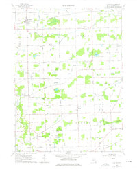
1962 Map of Clayton
USGS Topo · Published 1976About this map
Clayton and the surrounding agricultural townships of Hudson, Dover, Medina, and Seneca define this Lenawee County landscape during the early 1960s. The map illustrates a productive rural economy where numerous Gravel Pits, Oil Wells, and Gas Wells are scattered among established farmsteads. Transportation is anchored by the New York Central and Wabash railroads, which connect smaller hubs like Cadmus and Seneca. The intricate drainage system, including the South Branch Raisin River and Bird Drain, highlights the engineering required to manage the low-lying terrain and the expansive Big Swamp Drain area. Local history is well-preserved through markers like the Grange Hall, the Demings Lake Church, and several burial grounds including South Dover Cemetery and Porter Cemetery.
Find a feature on this map
64 named features on this map. Tap any name to fly to it.
Don’t see what you’re looking for? This feature index may not catch every label — zoom into the map to look around manually.
Map Details
Editions of this 1962 Clayton Map
Other maps of this area

1911 · Wauseon
USGS Topo · 1:62,500

1913 · Wauseon
USGS Topo · 1:62,500

1913 · Alvordton
USGS Topo · 1:62,500

1943 · Wauseon
USGS Topo · 1:62,500

1944 · Alvordton
USGS Topo · 1:62,500

1953 · Fort Wayne
USGS Topo · 1:250,000

1956 · Fort Wayne
USGS Topo · 1:250,000

1960 · Morenci
USGS Topo · 1:24,000

1960 · Fayette
USGS Topo · 1:24,000
1960 · Lyons
USGS Topo · 1:24,000