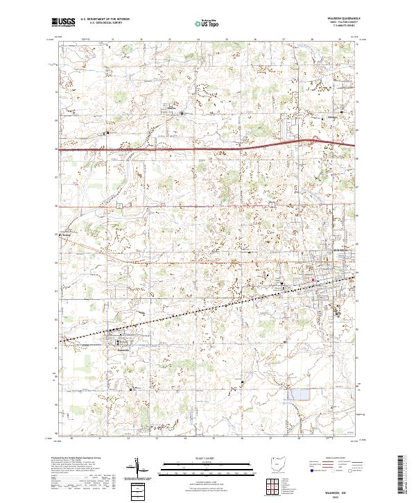
1943 Map of Wauseon
USGS Topo · Published 1944About this map
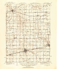
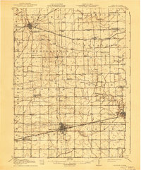
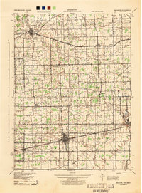
Wauseon and Delta serve as primary rail hubs during the early 1940s, situated at the intersection of a dense transportation network that includes the Wabash RR and the New York Central RR. This landscape is defined by the grid-like organization of Fulton County, Ohio, and Lenawee County, Michigan, where the boundary between states is clearly delineated. The map reveals an agrarian society organized around dozens of numbered and named local schools, such as the Swamp Angel Sch and Burmah Sch, suggesting the community structure of the era before district consolidation. A unique industrial detail is found in the Ohio and Morenci RR connecting Morenci to smaller settlements like Denson. From the County Fairgrounds at Ottokee to the small stop at Tedrow, the map documents a transition from old pioneer locations to established railway towns.
Find a feature on this map
71 named features on this map. Tap any name to fly to it.
Don’t see what you’re looking for? This feature index may not catch every label — zoom into the map to look around manually.
Map Details
Editions of this 1943 Wauseon Map
This is the sole edition of this map. No revisions or reprints were ever made.
Historical Maps of Wauseon Through Time
9 maps found