
1960 Map of Fayette
USGS Topo · Published 1961About this map
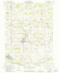
The village of Fayette serves as the focal point of this borderlands survey, where the agricultural plains of northwest Ohio meet southern Michigan. In the early 1960s, the landscape is defined by a dense grid of section roads and small woodlots, with the Michigan-Ohio state line cutting directly through the northern portion of the quadrangle. To the south, the Harrison Lake State Reservation and Camp Palmer provide a recreational contrast to the surrounding farmsteads. Numerous rural burial grounds, including Snow Cem, Goss Cem, and County Line Cem, are preserved here, offering valuable reference points for genealogists. The drainage pattern is complex, with Spring Creek, Bean Creek, and Wabash Creek winding through the terrain, occasionally punctuated by unique features like a Flowing Well or a local Gravel Pit. Small hamlets such as Munson and Powers mark the outlying corners of the township.
Find a feature on this map
30 named features on this map. Tap any name to fly to it.
Don’t see what you’re looking for? This feature index may not catch every label — zoom into the map to look around manually.
Map Details
Editions of this 1960 Fayette Map
4 editions found
Other maps of this area

1911 · Wauseon
USGS Topo · 1:62,500

1913 · Wauseon
USGS Topo · 1:62,500

1913 · Alvordton
USGS Topo · 1:62,500

1943 · Wauseon
USGS Topo · 1:62,500

1944 · Alvordton
USGS Topo · 1:62,500

1953 · Fort Wayne
USGS Topo · 1:250,000

1956 · Fort Wayne
USGS Topo · 1:250,000

1959 · Archbold
USGS Topo · 1:24,000
1960 · Wauseon
USGS Topo · 1:24,000

1960 · Morenci
USGS Topo · 1:24,000