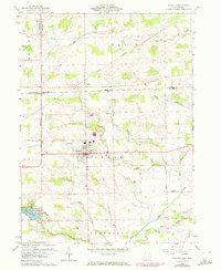
1960 Map of Fayette
USGS Topo · Published 1972About this map
Fayette serves as the central hub of this borderland survey, situated where the Michigan Ohio state line meets the convergence of Gorham and Franklin townships. The landscape is defined by the winding course of Bean Creek and its many tributaries, including Toad Creek and Iron Creek, which drain a region of productive agricultural fields and scattered woodlots. This 1960s-era topography reveals a rural economy still tied to the Norfolk and Western rail corridor and localized industry like the Gravel Pit near Munson.
Find a feature on this map
31 named features on this map. Tap any name to fly to it.
Don’t see what you’re looking for? This feature index may not catch every label — zoom into the map to look around manually.
Map Details
Editions of this 1960 Fayette Map
4 editions found

Other maps of this area

1911 · Wauseon
USGS Topo · 1:62,500

1913 · Wauseon
USGS Topo · 1:62,500

1913 · Alvordton
USGS Topo · 1:62,500

1943 · Wauseon
USGS Topo · 1:62,500

1944 · Alvordton
USGS Topo · 1:62,500

1953 · Fort Wayne
USGS Topo · 1:250,000

1956 · Fort Wayne
USGS Topo · 1:250,000

1959 · Archbold
USGS Topo · 1:24,000
1960 · Wauseon
USGS Topo · 1:24,000

1960 · Morenci
USGS Topo · 1:24,000