
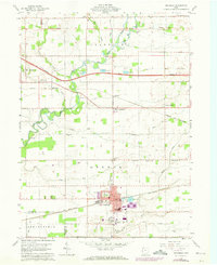
1959 Map of Archbold
USGS Topo · Published 1961About this map
The railroad town of Archbold serves as a hub of activity in this 1959 survey, anchored by the New York Central and Wabash rail lines. The landscape is defined by the winding course of the Tiffin River and Bean Creek, which are reinforced by a Levee system to protect the surrounding agricultural lands. Notable civic and community landmarks include Ruihley Park and the Archbold Cemetery, while the northern portion of the map is bisected by the modern infrastructure of the Ohio Turnpike and its associated Borrow Pits.
Find a feature on this map
49 named features on this map. Tap any name to fly to it.
Don’t see what you’re looking for? This feature index may not catch every label — zoom into the map to look around manually.
Map Details
Editions of this 1959 Archbold Map
2 editions found
Other maps of this area

1907 · Defiance
USGS Topo · 1:62,500

1908 · Napoleon
USGS Topo · 1:62,500

1909 · Defiance
USGS Topo · 1:62,500

1911 · Wauseon
USGS Topo · 1:62,500

1913 · Wauseon
USGS Topo · 1:62,500

1913 · Alvordton
USGS Topo · 1:62,500

1943 · Wauseon
USGS Topo · 1:62,500

1944 · Alvordton
USGS Topo · 1:62,500

1953 · Fort Wayne
USGS Topo · 1:250,000

1956 · Fort Wayne
USGS Topo · 1:250,000