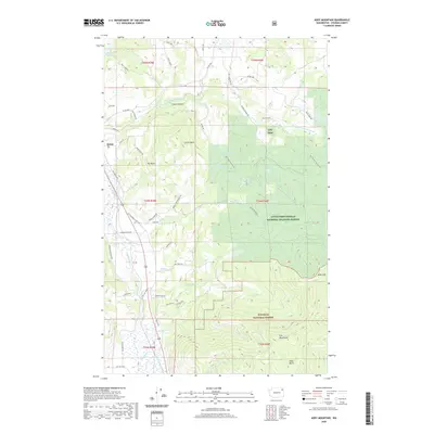
2020 Map of Addy Mountain
USGS Topo · Published 2020About this map
The Colville River and Little Pend Oreille River define the lower elevations of this Stevens County landscape, where the settlement of Arden sits near the junction of several historic routes. To the east, the terrain rises sharply into the protected lands of the Little Pend Oreille National Wildlife Refuge and the Colville National Forest. This 2020 survey illustrates a complex network of forest and county roads, such as Kitt-Narcisse Rd and Old Arden Hwy, that provide access to the area's prominent peaks and basins.
Find a feature on this map
62 named features on this map. Tap any name to fly to it.
Don’t see what you’re looking for? This feature index may not catch every label — zoom into the map to look around manually.
Map Details
Editions of this 2020 Addy Mountain Map
This is the sole edition of this map. No revisions or reprints were ever made.
Other maps of this area

1927 · Chewelah
USGS Topo · 1:125,000

1929 · Colville
USGS Topo · 1:125,000

1930 · Chewelah
USGS Topo · 1:125,000

1933 · Colville
USGS Topo · 1:125,000

1952 · White Mud Lake
USGS Topo · 1:24,000

1952 · Colville
USGS Topo · 1:24,000

1958 · Sandpoint
USGS Topo · 1:250,000

1963 · Sandpoint
USGS Topo · 1:250,000

1964 · Chewelah
USGS Topo · 1:24,000

1964 · Cliff Ridge
USGS Topo · 1:24,000