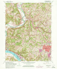
1960 Map of Addyston
USGS Topo · Published 1971About this map
The Great Miami River winds southward through Hamilton County, meeting the Ohio River at the distinctive North Bend Bottom. This landscape is defined by its transit corridors and river-bend settlements, including the industrial and residential corridors of Addyston and North Bend. The 1970 revisions highlight the suburban expansion of Bridgetown and Mack, where new residential streets like Woodhaven Dr and institutions such as Oak Hills High Sch and Our Lady of Visitation Ch mark the changing character of the Green township area.
Find a feature on this map
86 named features on this map. Tap any name to fly to it.
Don’t see what you’re looking for? This feature index may not catch every label — zoom into the map to look around manually.
Map Details
Editions of this 1960 Addyston Map
Other maps of this area

1914 · West Cincinnati
USGS Topo · 1:62,500

1915 · Lawrenceburg
USGS Topo · 1:48,000

1915 · Harrison
USGS Topo · 1:48,000

1915 · Hamilton
USGS Topo · 1:62,500

1917 · Hamilton
USGS Topo · 1:62,500

1928 · Lawrenceburg
USGS Topo · 1:62,500

1932 · Lawrenceburg
USGS Topo · 1:62,500

1943 · Hooven
USGS Topo · 1:24,000

1943 · Lawrenceburg
USGS Topo · 1:24,000

1950 · Covington
USGS Topo · 1:24,000