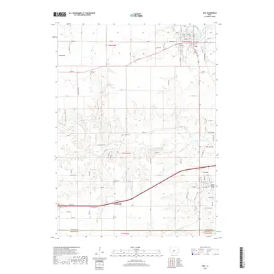
2018 Map of Adel
USGS Topo · Published 2018About this map
The South Raccoon River and North Raccoon River converge just east of Adel, a landscape defined by the winding waterways of Dallas County. The area’s cemetery records are well-documented here, with sites including Gibson Cem, Panther Creek Cem, Longmire Cem, Ellis Cem, and McKibben Cem scattered across the rural townships. Transportation history is marked by the Adel Bridge and the Bulger Creek Bridge, which connect the town of Adel to outlying settlements like Kennedy and Garretville. The road network shows a transition from traditional routes like Horse-N-Buggy Dr to modern highway corridors, while the southern edge of the map follows the Dallas Co Madison Co border. Significant drainage systems such as Bulger Creek and Panther Creek carve through the agricultural land, illustrating the complex hydrography that has shaped local settlement patterns for generations.
Find a feature on this map
88 named features on this map. Tap any name to fly to it.
Don’t see what you’re looking for? This feature index may not catch every label — zoom into the map to look around manually.
Map Details
Editions of this 2018 Adel Map
This is the sole edition of this map. No revisions or reprints were ever made.
Other maps of this area

1908 · Waukee
USGS Topo · 1:62,500

1949 · Adel
USGS Topo · 1:62,500

1951 · Adel
USGS Topo · 1:62,500

1951 · St. Charles
USGS Topo · 1:62,500

1952 · Winterset
USGS Topo · 1:62,500

1954 · Omaha
USGS Topo · 1:250,000

1954 · Des Moines
USGS Topo · 1:250,000

1956 · Des Moines
USGS Topo · 1:250,000

1957 · Des Moines
USGS Topo · 1:250,000

1957 · Omaha
USGS Topo · 1:250,000