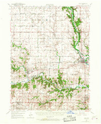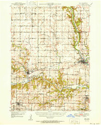
1951 Map of Adel
USGS Topo · Published 1951About this map
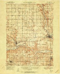
The North Raccoon River, Middle Raccoon River, and South Raccoon River converge across this Dallas County landscape, defining the local topography and settlement patterns. The county seat of Adel sits prominently along the eastern bank of the main river, while the town of Redfield serves as a western hub near the river forks. This mid-century survey illustrates a dense network of rural infrastructure, including a systematic distribution of one-room schoolhouses like School No 7 and Washington Sch, alongside family-named landmarks and cemeteries such as Gleason Cem and Longmire Cem.
Find a feature on this map
81 named features on this map. Tap any name to fly to it.
Don’t see what you’re looking for? This feature index may not catch every label — zoom into the map to look around manually.
Map Details
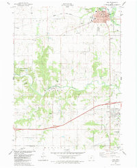
Editions of this 1951 Adel Map
2 editions found
Historical Maps of Adel Through Time
8 maps found