
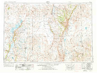
1955 Map of Adel
USGS Topo · Published 1971About this map
Warner Valley serves as a stark focal point for this mid-century survey of the high desert, where a chain of shallow basins including Crump Lake and Hart Lake define the hydrology of the Great Basin. This era captures the region's managed wilderness under the oversight of the Hart Mountain National Antelope Refuge and Malheur National Wildlife Refuge. The map illustrates the extreme isolation of small outposts like Adel, Frenchglen, and Fields, which are connected by early iterations of routes like 140. The topography is dominated by massive fault-block features such as Steens Mountain and the Pueblo Mountains, overlooking the arid expanse of the Alvord Desert. These varied landforms provided a complex environment for the ranching operations and wildlife conservation efforts that have long characterized Lake and Harney counties.
Find a feature on this map
39 named features on this map. Tap any name to fly to it.
Don’t see what you’re looking for? This feature index may not catch every label — zoom into the map to look around manually.
Map Details
Editions of this 1955 Adel Map
2 editions found
Other maps of this area

1882 · Paradise
USGS Topo · 1:250,000

1886 · Alturas
USGS Topo · 1:250,000

1886 · Disaster
USGS Topo · 1:250,000

1889 · Long Valley
USGS Topo · 1:250,000

1892 · Alturas
USGS Topo · 1:250,000

1893 · Paradise
USGS Topo · 1:250,000

1893 · Disaster
USGS Topo · 1:250,000

1954 · Vya
USGS Topo · 1:250,000

1954 · Alturas
USGS Topo · 1:250,000

1955 · McDermitt
USGS Topo · 1:250,000