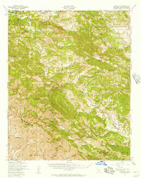
1947 Map of Adelaida
USGS Topo · Published 1957About this map
The Santa Lucia Range dominates this mid-century landscape of San Luis Obispo County, where steep terrain and winding creek canyons dictated the pattern of ranching and mining. Local commerce and community life centered on small outposts like Adelaida and Klau, supported by a network of rural schoolhouses including Lincoln Sch and Mammoth Rock Sch. The area's industrial footprint is visible through the Klau Mine, Oceanic Mine, and the Lime Mountain Quarry, showing the extractive activities that drove the local economy alongside established spreads like Santa Rita Ranch and Kentucky Ranch.
Find a feature on this map
42 named features on this map. Tap any name to fly to it.
Don’t see what you’re looking for? This feature index may not catch every label — zoom into the map to look around manually.
Map Details
Editions of this 1947 Adelaida Map
2 editions found
Other maps of this area

1897 · San Luis Obispo
USGS Topo · 1:62,500

1897 · Cayucos
USGS Topo · 1:62,500

1900 · San Luis
USGS Topo · 1:125,000

1919 · San Miguel
USGS Topo · 1:62,500

1919 · Bryson
USGS Topo · 1:62,500

1919 · Paso Robles
USGS Topo · 1:62,500

1919 · Bradley
USGS Topo · 1:62,500

1919 · Adelaida
USGS Topo · 1:62,500

1919 · San Simeon
USGS Topo · 1:62,500

1932 · Adelaida
USGS Topo · 1:62,500