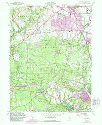
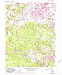
1957 Map of Adelphia
USGS Topo · Published 1989About this map
Freehold anchors the northern portion of this landscape, where the urban extension of the borough meets the transitioning countryside of Monmouth and Ocean counties. The terrain is defined by a series of mill-based settlements along the river branches, including Wyckoff Mills, Oakland Mills, and Bennetts Mills. These locations, alongside the Jacksons Mills Lake and Aldrich Lake, highlight a legacy of water-powered industry and community centers established near the headwaters of the North Branch Metedeconk River and South Branch Metedeconk River.
Find a feature on this map
46 named features on this map. Tap any name to fly to it.
Don’t see what you’re looking for? This feature index may not catch every label — zoom into the map to look around manually.
Map Details
Editions of this 1957 Adelphia Map
5 editions found
Other maps of this area

1888 · New Brunswick
USGS Topo · 1:62,500

1888 · Asbury Park
USGS Topo · 1:62,500

1888 · Cassville
USGS Topo · 1:62,500

1888 · Sandy Hook
USGS Topo · 1:62,500

1893 · New Brunswick
USGS Topo · 1:62,500

1893 · Sandy Hook
USGS Topo · 1:62,500

1893 · Asbury Park
USGS Topo · 1:62,500

1894 · Cassville
USGS Topo · 1:62,500

1900 · Cassville
USGS Topo · 1:62,500

1901 · New Brunswick
USGS Topo · 1:62,500