
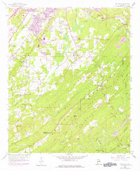
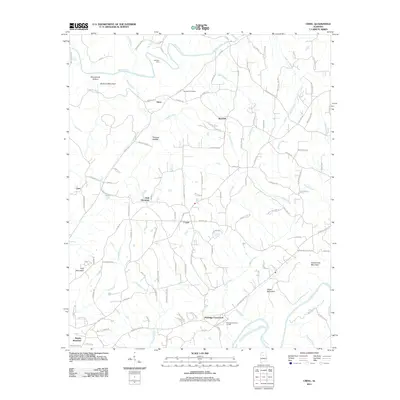
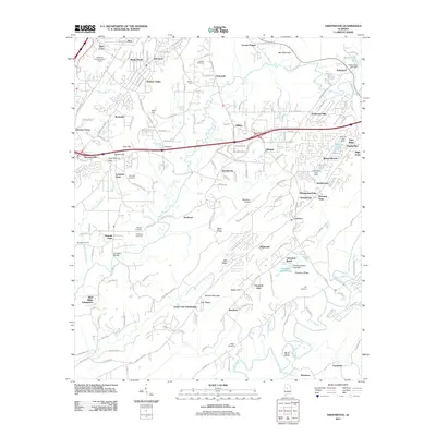
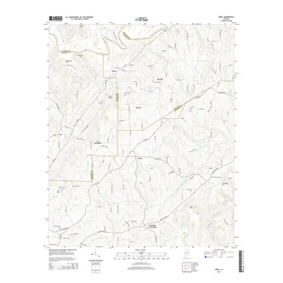
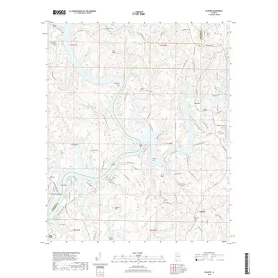
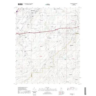
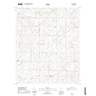
1927 Map of Adger
USGS Topo · Published 1927About this map
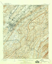
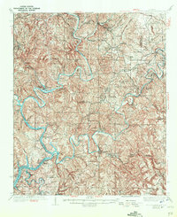
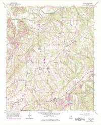
Industrial activity defines this 1927 survey of the borderlands between Jefferson and Tuscaloosa Counties. Connellsville Mine and Gilmore Mines stand as central economic hubs, connected by a network of the Louisville and Nashville and Southern railroads. These lines served several specialized junctions and switches such as Connellsville Jc, Apache Switch, and Chinn Switch, illustrating the region's role in Alabama's early 20th-century coal and iron production. Along the winding waters of Mud Creek, geography dictated settlement patterns, most notably at the dramatic river loop of Sextons Bend and the narrow passage of The Narrows. Away from the rail corridors, the map documents a rural landscape of faith and education, including Dogwood Ch, Concord Ch, and Boyd School. Historically significant sites like the iron-working center at Tannehill and the ridge of Red Mountain anchor the southeastern portion of the sheet.
Find a feature on this map
97 named features on this map. Tap any name to fly to it.
Don’t see what you’re looking for? This feature index may not catch every label — zoom into the map to look around manually.
Map Details
Editions of this 1927 Adger Map
This is the sole edition of this map. No revisions or reprints were ever made.
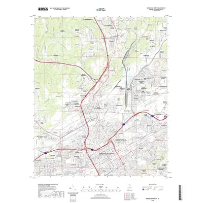
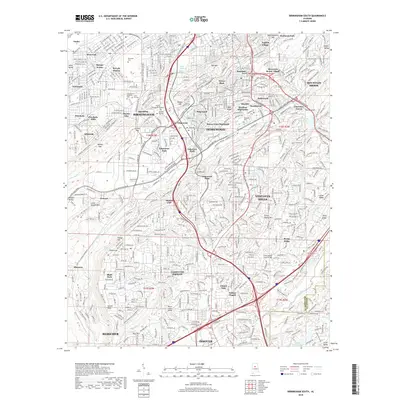
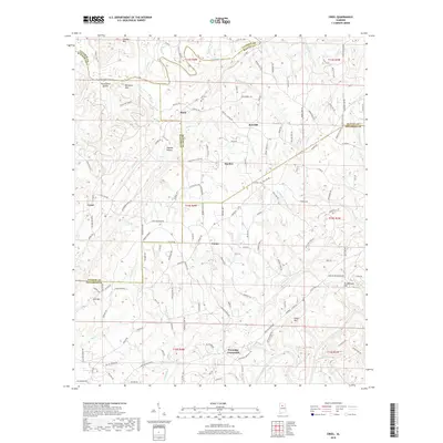
Historical Maps of Birmingham Through Time
57 maps found

1904 Birmingham Coal District
Jefferson County, AL
1905 Bessemer Iron District
Jefferson County, AL
1906 Birmingham Coal District
Jefferson County, AL
1907 Bessemer Iron District
Jefferson County, AL
1927 Adger
Jefferson County, AL

1932 Yolande
Jefferson County, AL

1935 Port Birmingham
Jefferson County, AL
1935 Yolande
Jefferson County, AL
1938 Port Birmingham
Jefferson County, AL
1951 Creel
Jefferson County, AL
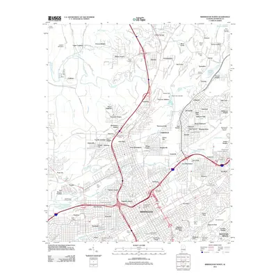
1959 Birmingham North
Jefferson County, AL
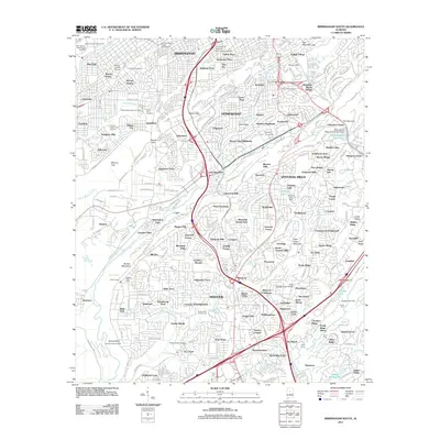
1959 Birmingham South
Jefferson County, AL
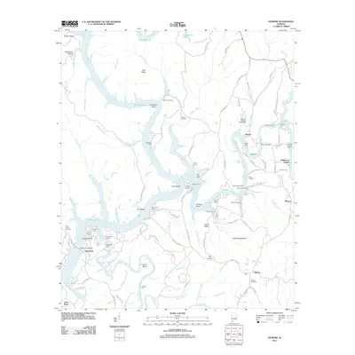
1959 Greenwood
Jefferson County, AL
1971 Gilmore
Jefferson County, AL

1975 Birmingham North
Jefferson County, AL

1975 Birmingham South
Jefferson County, AL

1975 Creel
Jefferson County, AL

1975 Gilmore
Jefferson County, AL

1975 Greenwood
Jefferson County, AL

1975 Yolande NE
Jefferson County, AL

1975 Yolande NW
Jefferson County, AL

1975 Yolande SE
Jefferson County, AL
1980 Mc Calla
Jefferson County, AL
1980 Oak Grove
Jefferson County, AL

1997 Birmingham North
Jefferson County, AL

1997 Birmingham South
Jefferson County, AL
2011 Birmingham North
Jefferson County, AL
2011 Birmingham South
Jefferson County, AL
2011 Creel
Jefferson County, AL
2011 Gilmore
Jefferson County, AL
2011 Greenwood
Jefferson County, AL
2011 Oak Grove
Jefferson County, AL
2014 Birmingham North
Jefferson County, AL
2014 Birmingham South
Jefferson County, AL
2014 Creel
Jefferson County, AL
2014 Gilmore
Jefferson County, AL
2014 Greenwood
Jefferson County, AL
2014 Oak Grove
Jefferson County, AL
2018 Birmingham North
Jefferson County, AL
2018 Birmingham South
Jefferson County, AL
2018 Creel
Jefferson County, AL
2018 Gilmore
Jefferson County, AL
2018 Greenwood
Jefferson County, AL
2018 Oak Grove
Jefferson County, AL
2020 Birmingham North
Jefferson County, AL
2020 Birmingham South
Jefferson County, AL
2020 Creel
Jefferson County, AL
2020 Gilmore
Jefferson County, AL
2020 Greenwood
Jefferson County, AL
2020 Oak Grove
Jefferson County, AL
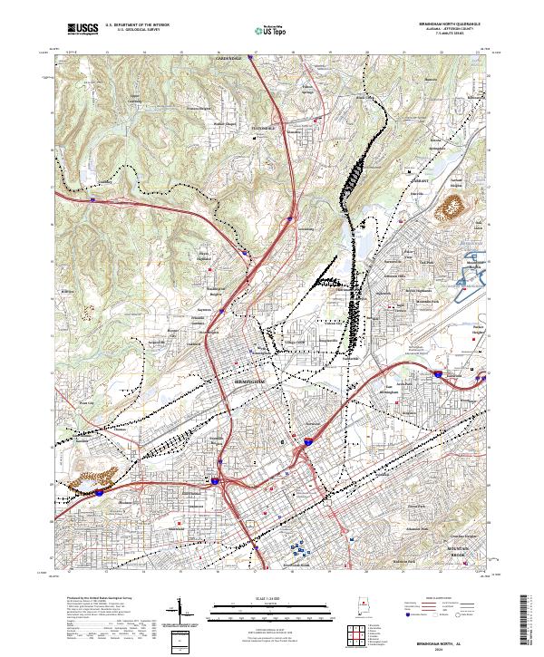
2024 Birmingham North
Jefferson County, AL
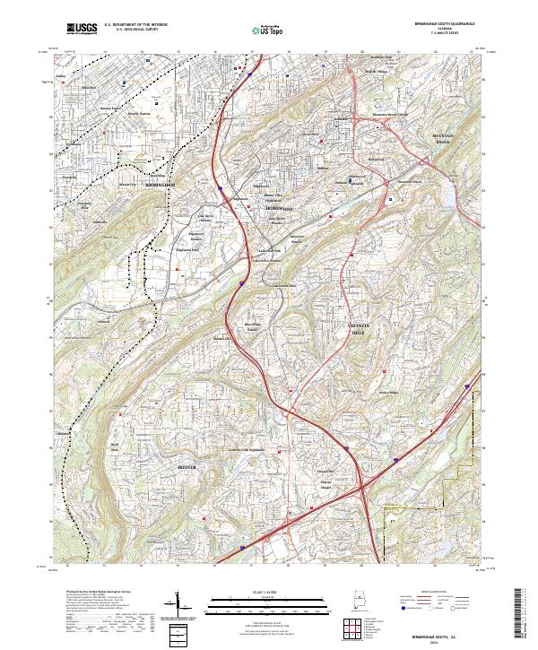
2024 Birmingham South
Jefferson County, AL
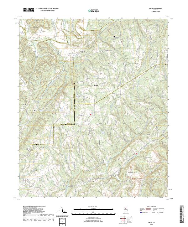
2024 Creel
Jefferson County, AL
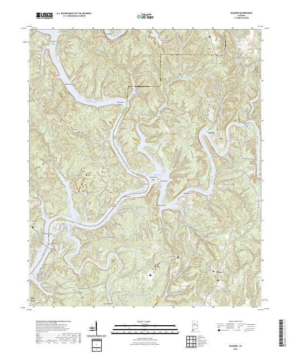
2024 Gilmore
Jefferson County, AL
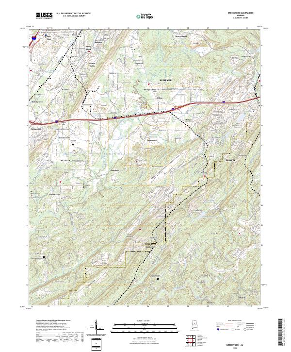
2024 Greenwood
Jefferson County, AL
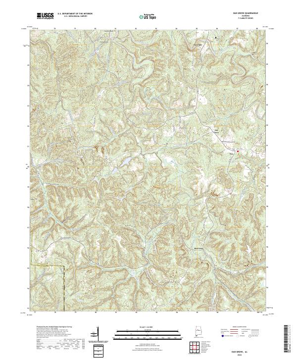
2024 Oak Grove
Jefferson County, AL
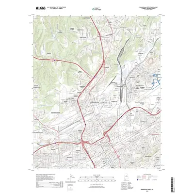
2026 Birmingham North
Jefferson County, AL