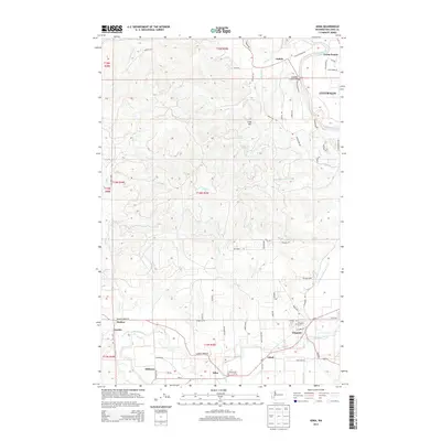
2014 Map of Adna
USGS Topo · Published 2014About this map
The Chehalis River valley defines the character of this 2014 survey, where small communities like Adna, Littell, and Claquato follow the water's path through Lewis County. This landscape represents a transition from the urban periphery of Centralia and Fords Prairie to the timber-dense hills of the west. To the south, the Claquato Cem stands as a significant waypoint near the river, while the former rail corridors are reflected in the alignment of settlements such as Millburn and Bunker. The terrain is marked by prominent rises like Cook Hill and a complex network of tributaries including Lincoln Cr and Mill Cr. The map captures the suburban expansion west of the city, where newer developments along Cooks Hill Rd meet the older rural foundations of places like Galvin and Fayette.
Find a feature on this map
77 named features on this map. Tap any name to fly to it.
Don’t see what you’re looking for? This feature index may not catch every label — zoom into the map to look around manually.
Map Details
Editions of this 2014 Adna Map
This is the sole edition of this map. No revisions or reprints were ever made.
Other maps of this area

1916 · Chehalis
USGS Topo · 1:125,000

1940 · Tenino
USGS Topo · 1:62,500

1941 · Meskill
USGS Topo · 1:62,500

1941 · Gate
USGS Topo · 1:62,500

1944 · Tenino
USGS Topo · 1:62,500

1949 · Tenino
USGS Topo · 1:62,500

1953 · Hoquiam
USGS Topo · 1:250,000

1953 · Rochester
USGS Topo · 1:62,500

1953 · Adna
USGS Topo · 1:62,500

1954 · Centralia
USGS Topo · 1:62,500