
1954 Map of Centralia
USGS Topo · Published 1956About this map
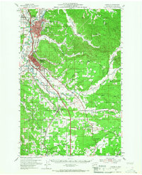
The Chehalis River and Skookumchuck River define the industrial and agricultural heart of Lewis County in the mid-1950s. This survey records the heavy concentration of rail infrastructure serving Centralia and Chehalis, where the Northern Pacific RR, Great Northern Ry, and Union Pacific RR converge. Beyond the urban centers, the landscape transitions into a series of distinct upland prairies, including Newaukum Prairie, Napavine Prairie, and Jackson Prairie, the latter home to the Jackson Prairie Courthouse.
Find a feature on this map
68 named features on this map. Tap any name to fly to it.
Don’t see what you’re looking for? This feature index may not catch every label — zoom into the map to look around manually.
Map Details
Editions of this 1954 Centralia Map
2 editions found
Other maps of this area

1916 · Chehalis
USGS Topo · 1:125,000

1940 · Tenino
USGS Topo · 1:62,500

1941 · Meskill
USGS Topo · 1:62,500

1941 · Olequa
USGS Topo · 1:62,500

1941 · Gate
USGS Topo · 1:62,500

1942 · Toutle
USGS Topo · 1:62,500

1943 · Willapa
USGS Topo · 1:62,500

1944 · Tenino
USGS Topo · 1:62,500

1944 · Yelm
USGS Topo · 1:62,500

1949 · Yelm
USGS Topo · 1:62,500