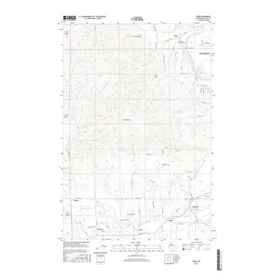
2017 Map of Adna
USGS Topo · Published 2017About this map
The Chehalis River meanders through this portion of Lewis County, anchoring a landscape defined by its river-valley settlements and agricultural drainage systems. The small communities of Adna, Littell, and Claquato trace the southern corridor, while the historic Claquato Cem stands as a significant genealogical landmark for the region. To the north, the terrain rises toward Cook Hill, giving way to the Lincoln Creek Valley and the settlement of Galvin. The presence of the Scheuber Drainage Ditch in the east highlights the managed hydrology of the lowland plains, while numerous named tributaries like Bunker Cr, Mill Cr, and Van Ornum Cr drain the surrounding hillsides. This detailed survey captures the modern road network and property divisions across several townships, illustrating the persistent rural character of the area west of Centralia.
Find a feature on this map
75 named features on this map. Tap any name to fly to it.
Don’t see what you’re looking for? This feature index may not catch every label — zoom into the map to look around manually.
Map Details
Editions of this 2017 Adna Map
This is the sole edition of this map. No revisions or reprints were ever made.
Other maps of this area

1916 · Chehalis
USGS Topo · 1:125,000

1940 · Tenino
USGS Topo · 1:62,500

1941 · Meskill
USGS Topo · 1:62,500

1941 · Gate
USGS Topo · 1:62,500

1944 · Tenino
USGS Topo · 1:62,500

1949 · Tenino
USGS Topo · 1:62,500

1953 · Hoquiam
USGS Topo · 1:250,000

1953 · Rochester
USGS Topo · 1:62,500

1953 · Adna
USGS Topo · 1:62,500

1954 · Centralia
USGS Topo · 1:62,500