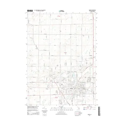
2014 Map of Adrian
USGS Topo · Published 2014About this map
Adrian and its academic institutions form the core of this Lenawee County landscape. The presence of Adrian Coll and Siena Heights Univ underscores the city's role as an educational center, while a significant concentration of burial grounds, such as Oakwood Cem and Saint Joseph's Catholic Cem, provides a detailed record for genealogists. The settlement at Birdsall sits north of the city near the Raisin Valley Orthodox Friends Cem. The hydrology is defined by the S Br River Raisin and Lake Adrian, with numerous drainage systems like Treat Drain and Harkness Drain etching the surrounding agricultural lands. The map reveals a dense grid of rural roads and highways, including Wolf Creek Hwy and N Adrian Hwy, connecting scattered homesteads and family cemeteries like Weaver Graves.
Find a feature on this map
164 named features on this map. Tap any name to fly to it.
Don’t see what you’re looking for? This feature index may not catch every label — zoom into the map to look around manually.
Map Details
Editions of this 2014 Adrian Map
This is the sole edition of this map. No revisions or reprints were ever made.
Other maps of this area

1904 · Ann Arbor
USGS Topo · 1:125,000

1906 · Saline
USGS Topo · 1:62,500

1908 · Ann Arbor
USGS Topo · 1:125,000

1939 · Blissfield
USGS Topo · 1:62,500

1941 · Blissfield
USGS Topo · 1:62,500

1948 · Manchester
USGS Topo · 1:62,500

1949 · Manchester
USGS Topo · 1:62,500

1953 · Fort Wayne
USGS Topo · 1:250,000

1954 · Detroit
USGS Topo · 1:250,000

1956 · Fort Wayne
USGS Topo · 1:250,000