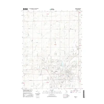
2017 Map of Adrian
USGS Topo · Published 2017About this map
The city of Adrian and the surrounding township of t6s r3e center this Lenawee County survey, defined by a complex drainage network feeding into the River Raisin. The landscape is notably dense with commemorative and religious sites, including the large Oakwood Cem and Saint Marys Cem, as well as the Raisin Valley Orthodox Friends Cem near the small community of Birdsall. To the north, agricultural tracts are etched with named waterways like Black Cr, Fisk Drain, and Treat Drain, while the impounded Lake Adrian serves as a prominent geographic landmark on the city's northern edge. The grid of rural roads, such as Tipton Hwy and Bent Oak Hwy, connects scattered burial grounds like Woerner Cem and Adrian Center Cem, offering researchers a detailed look at the distribution of early settlements and family landholdings across the county.
Find a feature on this map
177 named features on this map. Tap any name to fly to it.
Don’t see what you’re looking for? This feature index may not catch every label — zoom into the map to look around manually.
Map Details
Editions of this 2017 Adrian Map
This is the sole edition of this map. No revisions or reprints were ever made.
Other maps of this area

1904 · Ann Arbor
USGS Topo · 1:125,000

1906 · Saline
USGS Topo · 1:62,500

1908 · Ann Arbor
USGS Topo · 1:125,000

1939 · Blissfield
USGS Topo · 1:62,500

1941 · Blissfield
USGS Topo · 1:62,500

1948 · Manchester
USGS Topo · 1:62,500

1949 · Manchester
USGS Topo · 1:62,500

1953 · Fort Wayne
USGS Topo · 1:250,000

1954 · Detroit
USGS Topo · 1:250,000

1956 · Fort Wayne
USGS Topo · 1:250,000