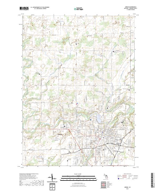
2023 Map of Adrian
USGS Topo · Published 2023About this map
Adrian serves as the focal point of this Lenawee County survey, situated at the confluence of several vital waterways including Wolf Creek and the South Branch River Raisin. The landscape is a mix of educational institutions and numerous burial grounds that reflect the long-standing community history of the region. Adrian College and Siena Heights University anchor the urban core, while the periphery is dotted with significant sites like the Saint Joseph's Catholic Cem and the County Poor House Cem. The drainage patterns, defined by features such as Black Creek and the Stevenson Drain, reveal how the natural hydrology of the area was managed to support local development. From the Rex B Martin Judicial Building in the city center to the smaller settlement of Birdsall to the northeast, this map documents the established social and civic infrastructure of this Michigan community in the early 2020s.
Find a feature on this map
174 named features on this map. Tap any name to fly to it.
Don’t see what you’re looking for? This feature index may not catch every label — zoom into the map to look around manually.
Map Details
Editions of this 2023 Adrian Map
This is the sole edition of this map. No revisions or reprints were ever made.
Other maps of this area

1904 · Ann Arbor
USGS Topo · 1:125,000

1906 · Saline
USGS Topo · 1:62,500

1908 · Ann Arbor
USGS Topo · 1:125,000

1939 · Blissfield
USGS Topo · 1:62,500

1941 · Blissfield
USGS Topo · 1:62,500

1948 · Manchester
USGS Topo · 1:62,500

1949 · Manchester
USGS Topo · 1:62,500

1953 · Fort Wayne
USGS Topo · 1:250,000

1954 · Detroit
USGS Topo · 1:250,000

1956 · Fort Wayne
USGS Topo · 1:250,000