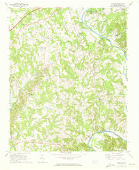
1969 Map of Advance
USGS Topo · Published 1972About this map
The Yadkin River serves as the primary geographical anchor for this Piedmont landscape, carving a winding border between Davie, Forsyth, and Davidson counties. Along its banks, the established recreation grounds of Tanglewood Park feature distinctive landmarks like Mallard Lake, Coon Lake, and Skilpot Lake. The interior of the sheet reveals a network of small agricultural and crossroads communities, including Advance, Bixby, and Redland, connected by the Southern railroad line. Local social life is mapped through several country churches and schools, such as Bethlehem Ch and the Smith Grove Sch. Aviation history is well-represented by the presence of Strawberry Hill Airport and Twin Lakes Air Park, illustrating the region's mid-century development. In the far south, Yadkin College stands near the river, while smaller watercourses like Dutchman Creek and Peoples Creek drain the surrounding wooded hills.
Find a feature on this map
37 named features on this map. Tap any name to fly to it.
Don’t see what you’re looking for? This feature index may not catch every label — zoom into the map to look around manually.
Map Details
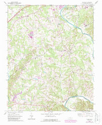
Editions of this 1969 Advance Map
2 editions found
Other maps of this area

1891 · Yadkinville
USGS Topo · 1:125,000

1893 · Statesville
USGS Topo · 1:125,000

1893 · Yadkinville
USGS Topo · 1:125,000

1950 · Winston-Salem West
USGS Topo · 1:24,000

1950 · Lexington West
USGS Topo · 1:24,000

1950 · Churchland
USGS Topo · 1:24,000

1951 · Winston-Salem West
USGS Topo · 1:24,000

1951 · Churchland
USGS Topo · 1:24,000

1951 · Lexington West
USGS Topo · 1:24,000

1953 · Charlotte
USGS Topo · 1:250,000