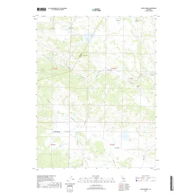
2018 Map of Aetna Springs
USGS Topo · Published 2018About this map
Aetna Springs and the surrounding canyon country sit along the winding border of Lake and Napa Counties in this 2018 topographic study. The landscape is defined by its drainage systems, with Pope Creek, Putah Creek, and Butts Creek carving through the terrain near peaks like Snell Peak and Devils Head Peak. This area, known for its historic mineral springs and viticulture potential, shows a distinct pattern of small valleys such as Snell Valley, Bohn Valley, and Spanish Valley that provide level ground amidst the steep ridges. Significant water features including Upper Bohn Lake, Weeks Lake, and Duvall Lake serve as local landmarks. The map traces a network of older corridors like Stagecoach Canyon Road and Oat Hill Road, reflecting the region’s long history as a passage between the coastal ranges and the interior valleys.
Find a feature on this map
44 named features on this map. Tap any name to fly to it.
Don’t see what you’re looking for? This feature index may not catch every label — zoom into the map to look around manually.
Map Details
Editions of this 2018 Aetna Springs Map
This is the sole edition of this map. No revisions or reprints were ever made.
Other maps of this area

1927 · Calistoga
USGS Topo · 1:62,500

1942 · St. Helena
USGS Topo · 1:62,500

1943 · Morgan Valley
USGS Topo · 1:62,500

1943 · Calistoga
USGS Topo · 1:62,500

1944 · Morgan Valley
USGS Topo · 1:62,500

1945 · Calistoga
USGS Topo · 1:62,500

1945 · St. Helena
USGS Topo · 1:62,500

1945 · Lower Lake
USGS Topo · 1:62,500

1947 · Santa Rosa
USGS Topo · 1:250,000

1949 · Santa Rosa
USGS Topo · 1:250,000