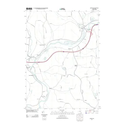
2013 Map of Afton
USGS Topo · Published 2013About this map
The Susquehanna River winds through this region of Broome County, anchoring a series of small riverside hamlets and historic crossroads. In Afton, the village layout is defined by the proximity of Afton Lake and the confluence of Bumps Cr and Kelsey Cr. The map reveals a high density of burial grounds, such as Baptist Cem and Eastside Cem, reflecting the deep genealogical roots of these communities. Moving downstream, the landscape transitions to the clusters of Nineveh and Nineveh Junction, where the river's path is closely followed by modern transportation corridors.
Find a feature on this map
102 named features on this map. Tap any name to fly to it.
Don’t see what you’re looking for? This feature index may not catch every label — zoom into the map to look around manually.
Map Details
Editions of this 2013 Afton Map
This is the sole edition of this map. No revisions or reprints were ever made.
Other maps of this area

1902 · Coventry
USGS Topo · 1:62,500

1904 · Oxford
USGS Topo · 1:62,500

1905 · Nineveh
USGS Topo · 1:62,500

1915 · Unadilla
USGS Topo · 1:62,500

1918 · Unadilla
USGS Topo · 1:62,500

1924 · Deposit
USGS Topo · 1:62,500

1926 · Deposit
USGS Topo · 1:62,500

1943 · Sidney
USGS Topo · 1:24,000

1944 · Deposit
USGS Topo · 1:62,500
1945 · Sidney
USGS Topo · 1:31,680