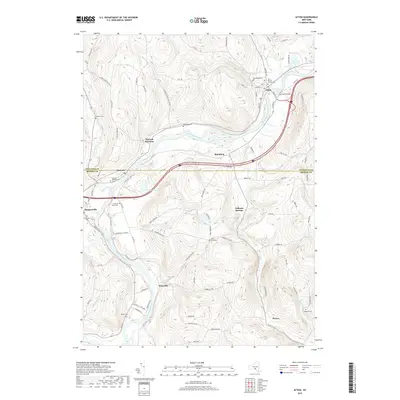
2019 Map of Afton
USGS Topo · Published 2019About this map
The Susquehanna River carves a deep valley through this landscape, acting as the primary corridor for settlement and transit between the towns of Afton and Harpursville. This 2019 survey captures the contemporary infrastructure of the region, where Interstate 88 follows the river’s path past Nineveh Junction and Bettsburg. The surrounding hillsides are punctuated by several small upland settlements, including Doraville and Vallonia Springs, which maintain their identity despite the shifting connectivity of modern highways.
Find a feature on this map
91 named features on this map. Tap any name to fly to it.
Don’t see what you’re looking for? This feature index may not catch every label — zoom into the map to look around manually.
Map Details
Editions of this 2019 Afton Map
This is the sole edition of this map. No revisions or reprints were ever made.
Other maps of this area

1902 · Coventry
USGS Topo · 1:62,500

1904 · Oxford
USGS Topo · 1:62,500

1905 · Nineveh
USGS Topo · 1:62,500

1915 · Unadilla
USGS Topo · 1:62,500

1918 · Unadilla
USGS Topo · 1:62,500

1924 · Deposit
USGS Topo · 1:62,500

1926 · Deposit
USGS Topo · 1:62,500

1943 · Sidney
USGS Topo · 1:24,000

1944 · Deposit
USGS Topo · 1:62,500
1945 · Sidney
USGS Topo · 1:31,680