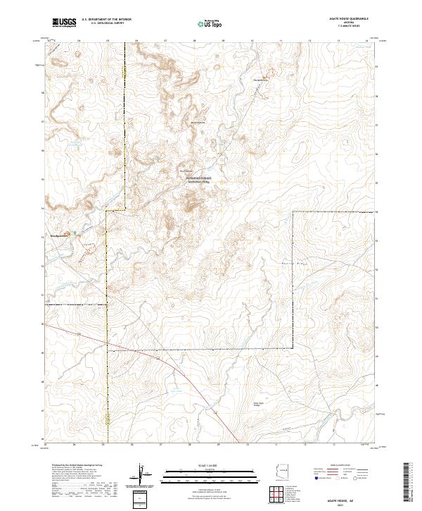
2021 Map of Agate House
USGS Topo · Published 2021About this map
Petrified Forest National Park occupies the central portion of this landscape at the boundary of Navajo and Apache Counties. The terrain is defined by a series of distinct geological formations, including the prominent Marthas Butte, The Flattops, and The Battleship in the north. The park's Headquarters serves as a primary point of infrastructure in the west, connected to the high desert interior by the Main Park Road and pedestrian routes like the Agate House Trl and Long Logs Trl.
Find a feature on this map
27 named features on this map. Tap any name to fly to it.
Don’t see what you’re looking for? This feature index may not catch every label — zoom into the map to look around manually.
Map Details
Editions of this 2021 Agate House Map
This is the sole edition of this map. No revisions or reprints were ever made.
Other maps of this area

1886 · St Johns
USGS Topo · 1:250,000

1892 · St Johns
USGS Topo · 1:250,000

1912 · Petrified Forest
USGS Topo · 1:62,500

1954 · Saint Johns
USGS Topo · 1:250,000

1955 · Petrified Forest
USGS Topo · 1:62,500

1955 · Adamana 1 SW
USGS Topo · 1:24,000

1955 · Adamana 3 NE
USGS Topo · 1:24,000

1955 · Adamana 4 NW
USGS Topo · 1:24,000

1955 · Hunt
USGS Topo · 1:62,500

1956 · Adamana 1 NW
USGS Topo · 1:24,000