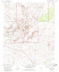
1982 Map of Agate House
USGS Topo · Published 1983About this map
Ancient human history and geologic marvels converge in the high desert within the Petrified Forest National Park. The landscape is dominated by the sprawling Puerco Ridge and deep drainage systems like Camp Wash and Milky Wash. Cultural landmarks are carefully documented, including the Agate House (Ruins) and various Petroglyphs near the Giant Logs Visitor Center.
Find a feature on this map
29 named features on this map. Tap any name to fly to it.
Don’t see what you’re looking for? This feature index may not catch every label — zoom into the map to look around manually.
Map Details
Editions of this 1982 Agate House Map
This is the sole edition of this map. No revisions or reprints were ever made.
Other maps of this area

1886 · St Johns
USGS Topo · 1:250,000

1892 · St Johns
USGS Topo · 1:250,000

1912 · Petrified Forest
USGS Topo · 1:62,500

1954 · Saint Johns
USGS Topo · 1:250,000

1955 · Petrified Forest
USGS Topo · 1:62,500

1955 · Adamana 1 SW
USGS Topo · 1:24,000

1955 · Adamana 3 NE
USGS Topo · 1:24,000

1955 · Adamana 4 NW
USGS Topo · 1:24,000

1955 · Hunt
USGS Topo · 1:62,500

1956 · Adamana 1 NW
USGS Topo · 1:24,000