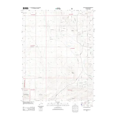
2013 Map of Agate Mountain
USGS Topo · Published 2013About this map
Agate Mountain rises as the central landmark in this high-altitude landscape within the San Isabel National Forest. This Park County terrain is defined by a sparse but distinct pattern of ranching and homesteading, featuring several historic family sites such as the Adleman Homestead, Jacobs Homestead, and Marshall Ranch. The drainage systems of Agate Cr and Wagon Tongue Cr carve through the land, supported by essential water sources like Birchfield Spring and Upper Pease Spring. A complex network of local roads and named trails, including Kanahuk Rd and Chickasaw Rd, provides access across the various townships. The mapping of Trump and individual dwellings like the Nedrow Homestead provides researchers with a precise record of rural occupancy in this part of Colorado during the early twenty-first century.
Find a feature on this map
81 named features on this map. Tap any name to fly to it.
Don’t see what you’re looking for? This feature index may not catch every label — zoom into the map to look around manually.
Map Details
Editions of this 2013 Agate Mountain Map
This is the sole edition of this map. No revisions or reprints were ever made.
Other maps of this area

1954 · Pueblo
USGS Topo · 1:250,000

1956 · Antero Reservoir
USGS Topo · 1:24,000

1956 · Antero Reservoir NE
USGS Topo · 1:24,000

1956 · Guffey NW
USGS Topo · 1:24,000

1956 · Cameron Mountain
USGS Topo · 1:62,500

1957 · Pueblo
USGS Topo · 1:250,000

1958 · Pueblo
USGS Topo · 1:250,000

1959 · Antero Reservoir
USGS Topo · 1:62,500

1959 · Black Mountain
USGS Topo · 1:62,500

1959 · Guffey
USGS Topo · 1:62,500