
1956 Map of Guffey NW
USGS Topo · Published 1957About this map
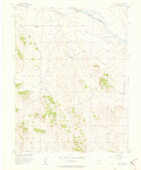
The South Platte River winds through the northern portion of this high-altitude landscape, marked by a complex network of ditches and the conspicuous Old Railroad Grade that follows the river's path. This mid-1950s survey captures a transition in the ranching history of Park County, clearly noting once-active sites like the Richardson No 2 Ranch (Aban'd) and Richardson No 1 Ranch (Aban'd) as no longer in use. The rugged topography is defined by major drainage systems like Buffalo Gulch and Threemile Creek, which cut between the prominent heights of Sulphur Mountain and Spinney Mountain. The presence of the Palat-Howe Ranch near the river suggests the continued importance of water access for livestock in this terrain during the mid-century era.
Find a feature on this map
12 named features on this map. Tap any name to fly to it.
Don’t see what you’re looking for? This feature index may not catch every label — zoom into the map to look around manually.
Map Details
Editions of this 1956 Guffey NW Map
2 editions found
Other maps of this area

1953 · Denver
USGS Topo · 1:250,000

1954 · Pueblo
USGS Topo · 1:250,000

1956 · Sulphur Mountain
USGS Topo · 1:24,000

1956 · Antero Reservoir NE
USGS Topo · 1:24,000

1956 · Hartsel
USGS Topo · 1:24,000

1956 · Glentivar
USGS Topo · 1:24,000

1956 · Spinney Mountain
USGS Topo · 1:24,000

1957 · Denver
USGS Topo · 1:250,000

1957 · Pueblo
USGS Topo · 1:250,000

1958 · Pueblo
USGS Topo · 1:250,000