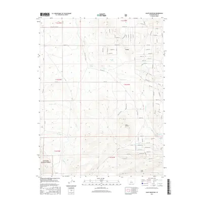
2016 Map of Agate Mountain
USGS Topo · Published 2016About this map
Trump serves as a central point of interest in this high-altitude landscape of Park County, where the terrain is defined by a complex network of named tribal-themed roads and trails. The map illustrates a transition from the public lands of the San Isabel National Forest in the southwest to a structured grid of residential or recreational paths such as Chimapai Trl, Jumano Trl, and Maskoke Trl. Hydrography is dominated by the seasonal flow of Agate Cr and Little Agate Cr, which originate near the prominent heights of Agate Mountain. The presence of Birchfield Spring and Upper Pease Spring indicates the vital importance of water sources in this dry, elevated environment. This 2016 survey documents the modern land divisions and access routes, including Co Rd 53, that permeate the area north of Long Gulch.
Find a feature on this map
80 named features on this map. Tap any name to fly to it.
Don’t see what you’re looking for? This feature index may not catch every label — zoom into the map to look around manually.
Map Details
Editions of this 2016 Agate Mountain Map
This is the sole edition of this map. No revisions or reprints were ever made.
Other maps of this area

1954 · Pueblo
USGS Topo · 1:250,000

1956 · Antero Reservoir
USGS Topo · 1:24,000

1956 · Antero Reservoir NE
USGS Topo · 1:24,000

1956 · Guffey NW
USGS Topo · 1:24,000

1956 · Cameron Mountain
USGS Topo · 1:62,500

1957 · Pueblo
USGS Topo · 1:250,000

1958 · Pueblo
USGS Topo · 1:250,000

1959 · Antero Reservoir
USGS Topo · 1:62,500

1959 · Black Mountain
USGS Topo · 1:62,500

1959 · Guffey
USGS Topo · 1:62,500