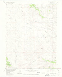
1983 Map of Agate Mountain
USGS Topo · Published 1983About this map
Trump and the high-elevation terrain of Horse Park define this 1980s landscape in Park County. The map details an environment shaped by water and extraction, where numerous ephemeral and permanent sources like Birchfield Spring, Upper Pease Spring, and Dry Lakes Creek converge. A system of jeep trails provides access to several unnamed quarries and prospects scattered across the slopes, indicating active mineral exploration or small-scale mining activity during this period.
Find a feature on this map
19 named features on this map. Tap any name to fly to it.
Don’t see what you’re looking for? This feature index may not catch every label — zoom into the map to look around manually.
Map Details
Editions of this 1983 Agate Mountain Map
This is the sole edition of this map. No revisions or reprints were ever made.
Other maps of this area

1954 · Pueblo
USGS Topo · 1:250,000

1956 · Antero Reservoir
USGS Topo · 1:24,000

1956 · Antero Reservoir NE
USGS Topo · 1:24,000

1956 · Guffey NW
USGS Topo · 1:24,000

1956 · Cameron Mountain
USGS Topo · 1:62,500

1957 · Pueblo
USGS Topo · 1:250,000

1958 · Pueblo
USGS Topo · 1:250,000

1959 · Antero Reservoir
USGS Topo · 1:62,500

1959 · Black Mountain
USGS Topo · 1:62,500

1959 · Guffey
USGS Topo · 1:62,500