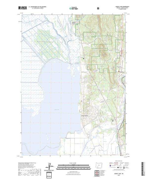
2024 Map of Agency Lake
USGS Topo · Published 2024About this map
Agency Lake and its surrounding wetlands dominate this portion of the Klamath Basin, where the Wood River and Williamson River converge near the eastern shore. The map details the transition from the aquatic environment of the Upper Klamath National Wildlife Refuge to the managed timberlands of the Winema National Forest. This landscape is deeply tied to the history of the Klamath Tribes, evidenced by the location of the Klamath Agency and local burial sites like Lobert Cem and Wilson Cem.
Find a feature on this map
34 named features on this map. Tap any name to fly to it.
Don’t see what you’re looking for? This feature index may not catch every label — zoom into the map to look around manually.
Map Details
Editions of this 2024 Agency Lake Map
This is the sole edition of this map. No revisions or reprints were ever made.
Other maps of this area

1889 · Klamath
USGS Topo · 1:250,000

1891 · Ashland
USGS Topo · 1:250,000

1893 · Ashland
USGS Topo · 1:250,000

1894 · Klamath
USGS Topo · 1:250,000

1897 · Ashland
USGS Topo · 1:250,000

1955 · Lake O' Woods
USGS Topo · 1:62,500

1955 · Pelican Butte
USGS Topo · 1:62,500

1955 · Klamath Falls
USGS Topo · 1:250,000

1955 · Medford
USGS Topo · 1:250,000

1957 · Medford
USGS Topo · 1:250,000