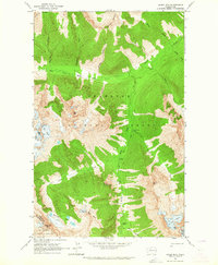
1963 Map of Agnes Mtn
USGS Topo · Published 1964About this map
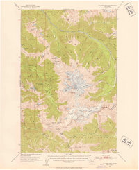
Agnes Creek and its many tributaries, including West Fork Agnes Creek and South Fork Agnes Creek, dominate this high-elevation landscape within the Okanogan National Forest. This 1963 field check records a series of established backcountry sites like Fivemile Camp, Swamp Creek Camp, and Cedar Camp, illustrating the mid-century infrastructure supporting travel through these peaks. The topography is defined by significant ice and water features, from the Chickamin Glacier and Blue Glacier in the west to the Bannock Lakes below Bannock Mtn. Stretching across the center of the map, the Cascade Crest Trail serves as the primary corridor through the wilderness, skirting around Mount Blankenship and Needle Peak. The boundary between Chelan and Snohomish counties is clearly marked as it traverses these heights.
Find a feature on this map
36 named features on this map. Tap any name to fly to it.
Don’t see what you’re looking for? This feature index may not catch every label — zoom into the map to look around manually.
Map Details
Editions of this 1963 Agnes Mtn Map
4 editions found


Other maps of this area

1899 · Glacier Peak
USGS Topo · 1:125,000

1901 · Glacier Peak
USGS Topo · 1:125,000

1902 · Stehekin
USGS Topo · 1:125,000

1904 · Stehekin
USGS Topo · 1:125,000
1944 · Holden
USGS Topo · 1:62,500
1949 · Holden
USGS Topo · 1:62,500
1950 · Glacier Peak
USGS Topo · 1:62,500

1955 · Concrete
USGS Topo · 1:250,000

1958 · Concrete
USGS Topo · 1:250,000

1962 · Concrete
USGS Topo · 1:250,000